Turn Site Imagery Into Data
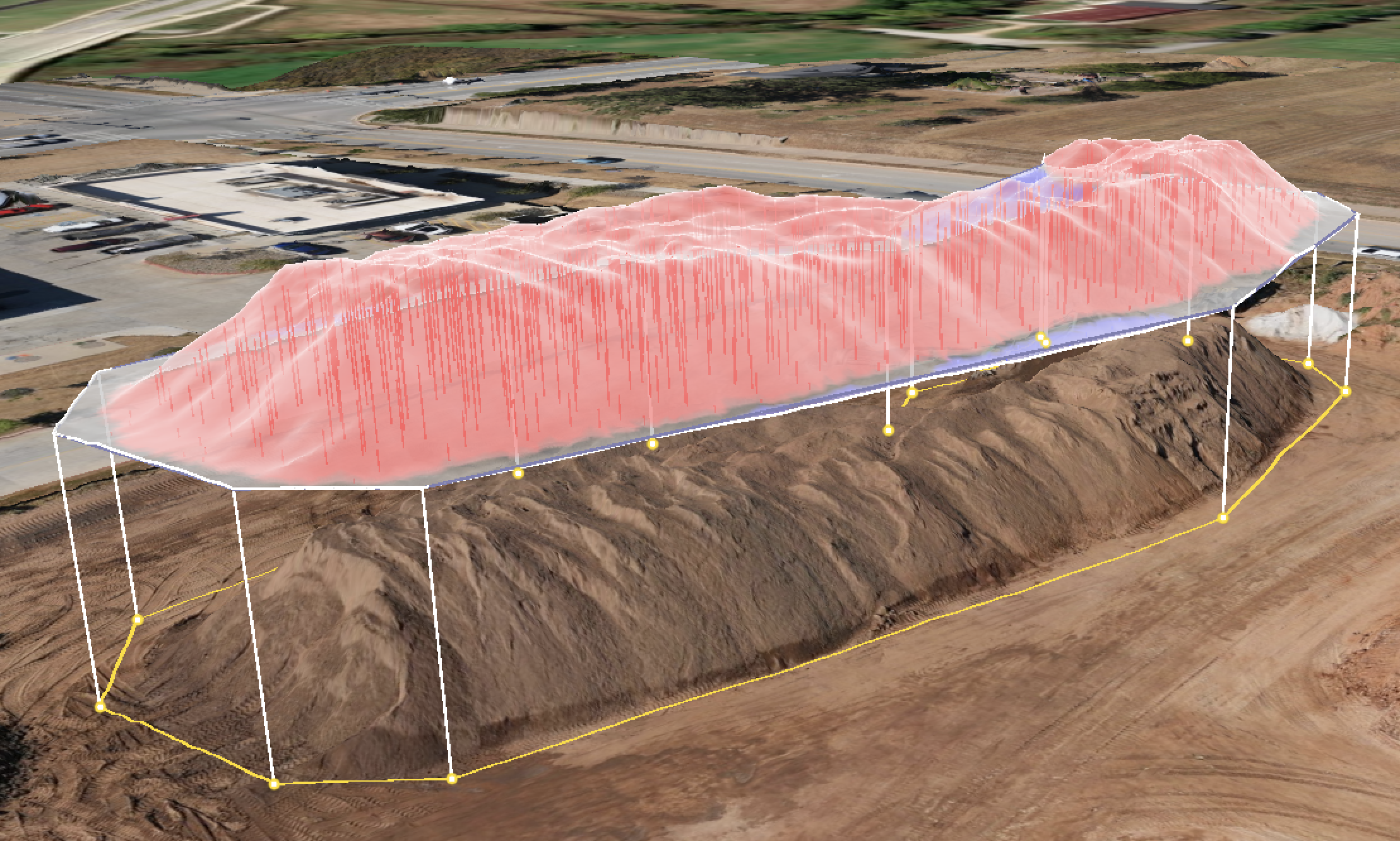
Photogrammetry uses overlapping, high-resolution aerial imagery to create accurate, measurable digital representations of a construction site. During each flight, hundreds of georeferenced images are captured from multiple positions and processed using specialized software that identifies common points between photographs and reconstructs their three-dimensional locations. When combined with precise positioning and ground control, this process produces detailed orthomosaics, point clouds, 3D models, digital elevation models, and surface data. These datasets allow real-world distances, elevations, slopes, areas, and volumes to be measured directly from an accurate digital representation of the site.
Volume Calculations
Elevation Analysis
Progress Documentation
Clear Project Insights
Make Every Flight Count
For contractors and engineers, photogrammetry turns current jobsite conditions into measurable data that can be compared with project plans and previous surveys.
Teams can verify elevations and grades, calculate stockpile and earthwork volumes, evaluate slopes and drainage, document installed work, monitor construction progress, and identify potential discrepancies before they become larger problems.
Repeated flights also create a historical record of the project, allowing teams to compare conditions over time and make decisions using current site information rather than relying solely on observations from the ground.
Stockpile Volumes
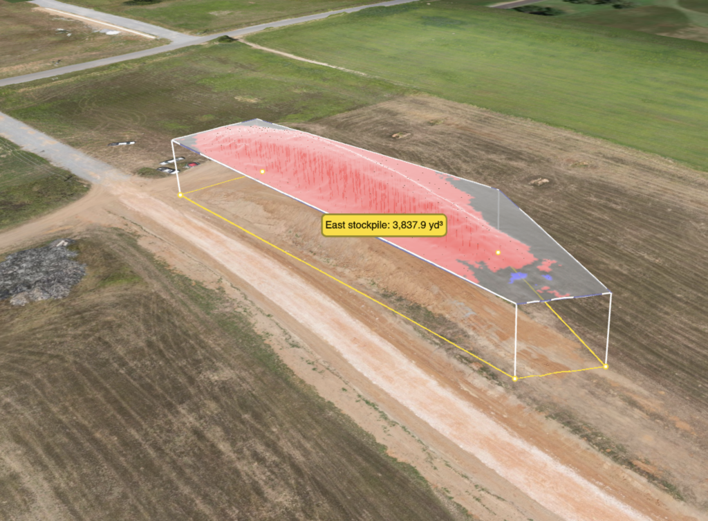
Quickly measure stockpiles and material quantities using accurate 3D site data. Photogrammetry allows volumes to be calculated directly from the site model, helping teams track material inventories, monitor changes, and document quantities over time.
Cut and Fill Review
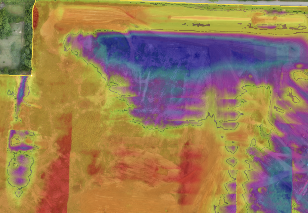
Compare current site conditions against proposed design surfaces to clearly identify areas of cut and fill. Color-coded heat maps provide an easy visual representation of earthwork conditions, while interactive maps allow teams to explore elevations and measurements in greater detail. Printable cut/fill maps can also be generated for field crews, meetings, and project documentation.
Ready for Better Site Data?
Get clear, accurate aerial data for your next civil construction project.